Sýnir færslur með efnisorðinu satellite. Sýna allar færslur

4. jún. 2010

Smoke free Iceland ;) ... not ash free though :p

Description
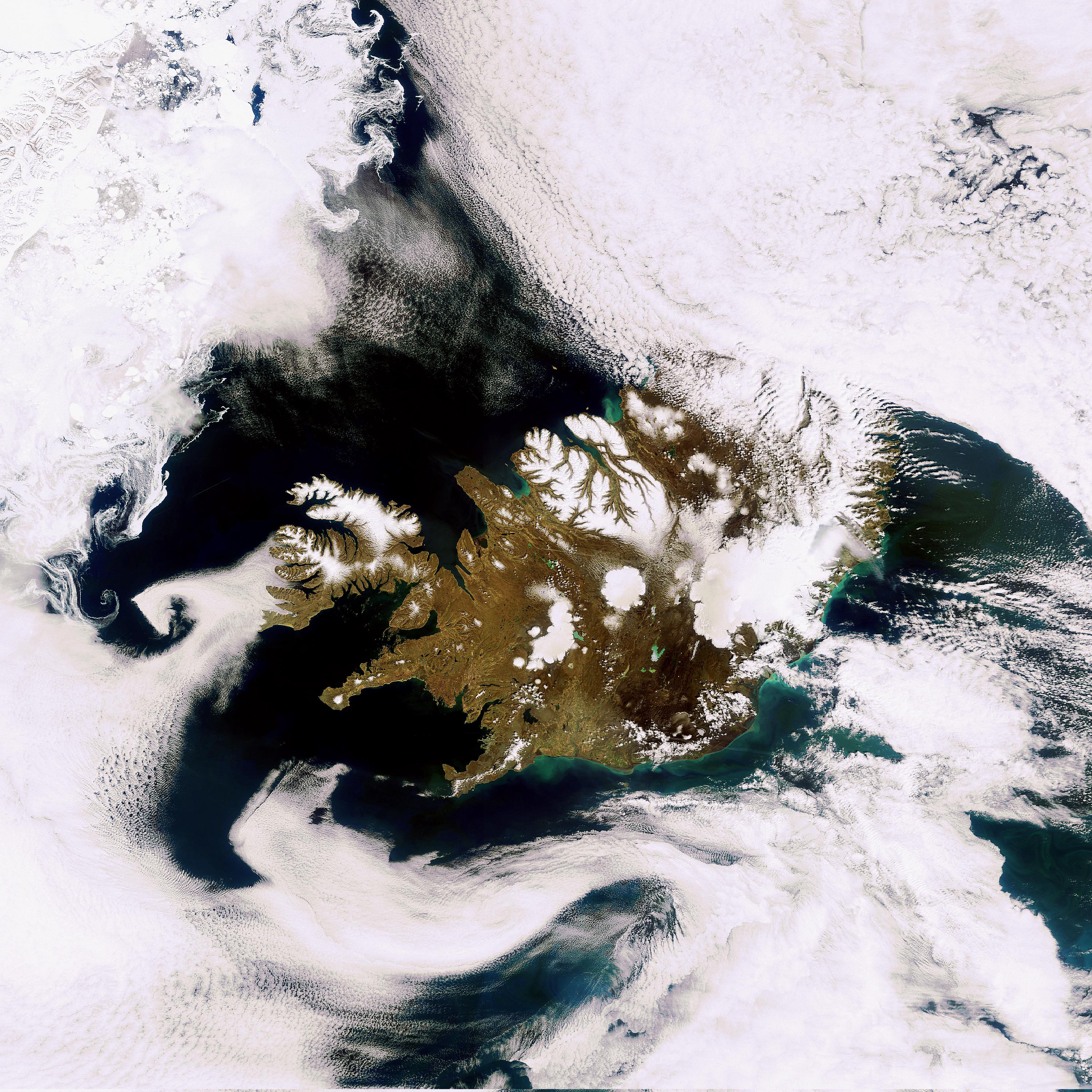
This image, acquired by Envisat’s Medium Resolution Imaging Spectrometer on 24 May 2010, features a smoke-free Iceland.
The Eyjafjallajokull volcano, which had a series of eruptions in April and May, is visible in the dark area on the southern coast. The Vatnajokull glacier (visible in white northeast of Eyjafjallajokull) is the largest in Iceland and in Europe. The white circular patch in the centre of the country is Hofsjokull, the country’s third largest glacier and its largest active volcano. The elongated white area west of Hofsjokull is Langjokull, Iceland’s second largest glacier.

Posted via web from Sigurdór's posterous

2. jún. 2010

Eruption of Eyjafjallajökull Volcano, Iceland April 17 on Flickr - Ash cloud seen from satellite

The MODIS instrument on NASA's Aqua satellite captured an Ash plume from Eyjafjallajokull Volcano over the North Atlantic at 13:20 UTC (9:20 a.m. EDT) on April 17, 2010.

The Eyjafjallajokull volcano in Iceland erupted Wednesday, April 14, for the second time this month. The volcano is still spewing ash into the air and the ash clouds are impacting air travel in Northern Europe.

NASA/GSFC/Jeff Schmaltz/MODIS Land Rapid Response Team

To read more go to: www.nasa.gov/topics/earth/features/iceland-volcano-plume....

NASA Goddard Space Flight Center is home to the nation's largest organization of combined scientists, engineers and technologists that build spacecraft, instruments and new technology to study the Earth, the sun, our solar system, and the universe. 

Posted via web from Sigurdór's posterous

Bloggsafn

Um mig / about me

Myndin mín
Bass player, father, husband, band member, musician, son, brother, hobby photographer, friend, coffee drinker,
    eXTReMe Tracker